Monthly Archives: September 2016

Fall Frost in Illinois


frost2

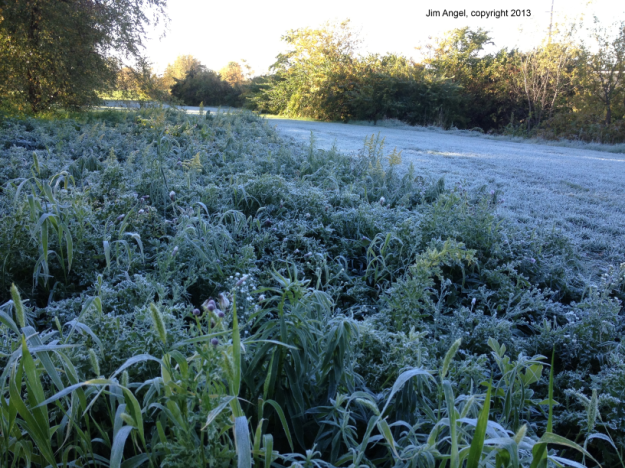
Fall frost near my office a few years ago, Jim Angel 2013.


Summary: the median dates for fall frost in Illinois range from early October in northern Illinois, to mid-October for central Illinois, and late October for southern Illinois.

Frost is the formation of thin ice crystals on the ground or other surfaces in the form of scales, needles, feathers, or fans. If a frost period is severe enough to end the growing season or delay its beginning, it is referred to as a “killing frost”.

Frost in both spring and fall can be a concern to farmers, landscapers, and gardeners. However, we usually do not directly measure frost at weather stations in Illinois. Sometimes observers may note the presence of frost in their comments on the forms. To get around the lack of direct observations, we use a temperature threshold of 32° for frost and 28° for a hard freeze.

Continue reading

September So Far – Warm and Rainy

So far September has been much warmer and somewhat wetter than normal for Illinois. The statewide average temperature for the month is 72.2 degrees, 4.3 degrees above normal. The statewide rainfall is 3.10 inches, 31% above normal for the month to date. Warm and rainy also applies to much of the rest of the Midwest.

Precipitation

Below are maps of the rainfall across the Midwest for September. The left panel is the actual rainfall, the right panel is the departure from normal. Rains have been widespread across the Midwest in September and generally near to above normal across much of MN, IA, MO, WI, IL, and IN. Meanwhile, MI, OH, and KY were mostly below normal. On closer examination, central and southern Illinois were near to above normal while northern Illinois has been a little drier.

The heaviest rains of 5 or more inches have occurred in two blue blobs (left panel): one blog from Kansas through southwestern Illinois; and another blob from NE and SD, eastward through IA, MN, and WI. The heavy rains in IA, MN, and WI may cause minor to moderate flooding in the next several days along the Mississippi River above St. Louis.

Temperatures

Continue reading

When Is Fall? Astronomical, Meteorological, Climatological?

Here are some thoughts on Fall that I wrote in 2014 …

Illinois State Climatologist

00quad_1280x1024 The Quad – University of Illinois in fall color.

No doubt today (September 22) will be announced as the “first day of fall” because of the fall or autumnal equinox. However, that concept refers to the date when we get equal amounts of daylight and dark.  I don’t think it was ever intended that this astronomical event would be the start of fall. In fact, this equinox would be the start of spring in the southern hemisphere. So to be fair to everyone we should call it the September equinox and leave fall out of it.  😉

Climatologists and meteorologists prefer to use calendar months to define the four seasons in the US. For example, fall would start September 1 and end on November 30. Not only is this more convenient, because you can use monthly data, but it lines up better with the typical or average temperature pattern for Illinois…

View original post 250 more words

Lake Michigan Warmer than Average in 2016

Lake Michigan has been warmer than average throughout 2016, according to the NOAA Coastwatch site.

Here are what the current surface water temperatures look like across the Great Lakes. Temperatures on the southern end of Lake Michigan are in the 70s and in the low 70s or upper 60s in much of the rest of the lake. There are some spots along the Wisconsin shore that are in the low 60s and 50s.

glsea_cur

Continue reading

New Seasonal Outlooks for Fall and Winter

The NWS Climate Prediction Center released their new monthly and seasonal outlooks for October, October-December, and January-March. Illinois has an increased chance of having above-normal temperatures for the rest of 2016. That is no surprise since every month in 2016, except May, has been above-normal for Illinois.

According to the NWS, the current ocean/atmosphere conditions in the Pacific reflect so-called ENSO-neutral conditions. This means that we are not in El Niño or La Niña conditions. There is only a 55-60 percent chance of La Niña showing up this fall or winter. And if it does show up, it is likely to be a weak event.

In the NWS forecasts, the term equal chances (EC) is used to identify areas where there is no clear signal of how temperature or precipitation might behave. The other way to look at it is that those are areas without an increased risk of being much above or below normal.

October

Continue reading